The last heat waver that affected the core region of the country, was for many the final blow for summer crops that were already badly affected by the drought and early frost that occurred in the middle of last month.
For the consultant Rosario Stock Exchange (BCR), Alfredo Elorriaga, there are no records for a long time of a scenario with high temperatures as recorded in recent days. “The extreme temperatures that have not ceased since the end of February, there are no records in the last 100 years of such a long heat wave – 18 consecutive days – and with such high minimum and maximum temperatures,” said the specialist in a report submitted by the entity.
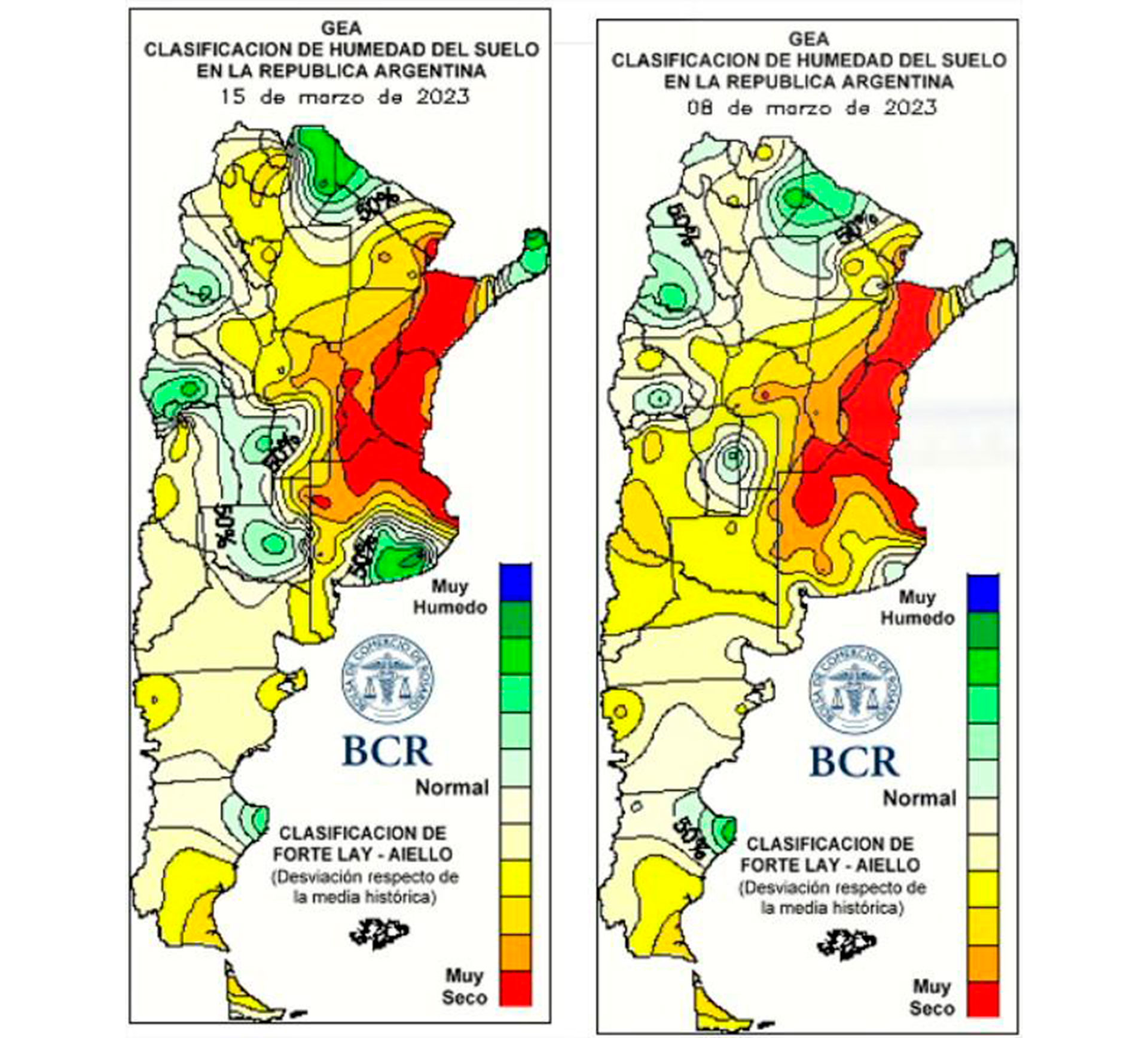
In addition, he expressed that “the striking thing was that the minimum temperatures during this period presented the same level as the average maximum temperatures of March, and the maximum temperatures were 10°C above the average maximum temperature for the month.” On the other hand, he pointed out that in the face of a complex scenario from a climatic point of view, the good news is that “forecasts indicate that from the second fortnight onwards, the blockade begins to move to the east and the circulation of the frontal systems increases its incursion towards the center of the country. This will cause a change in air mass, a general drop in temperatures and the development of rains and storms that, although still erratic and disparate, will increase their coverage area towards the center of the country”.
Yesterday in its weekly survey, as a consequence of the drought and high temperatures, the Buenos Aires Grain Exchange once again cut estimates of the total harvest of soybean and corn. In the case of the oilseed, the estimate was cut by 4 million tons, which now stands at 25 million tons. This is a figure that represents a year-on-year drop of 42.2% and 44.4% in relation to the last 5 campaigns. On the cereal side, the downward adjustment was 1.5 million tons and the projection is now 36 million tons, 16 million tons less compared to the previous season.
The middle of the month of March ends with an unprecedented heat wave and little rain in the core region. In this regard, the climate specialist explained that the cause of this event “was the persistence of an atmospheric blockade, associated with the position of the Atlantic anticyclone over the central area of the country. This intense center of high pressure located off the east coast of Argentina has prevented the entry of frontal systems towards the center of the country for the last 45 days. The result was a virtual traffic barrier that hindered the advance of rains and storms beyond the center of Buenos Aires, La Pampa and the western fringe of the Pampas region, reaching the north of the country. That is to say, an invisible bell that kept the rains away from the southeast of Córdoba, center-south of Santa Fe, Entre Ríos and north of Buenos Aires”.
Finally, he raised in terms of climate perspective for what comes that today there will be a front that will favor the south of the core region. Starting Monday, isolated and intermittent rainfall is expected that will benefit the western fringe. “The blockade begins to move to the east. This will cause a change in air mass, a general drop in temperatures and the development of rains and storms in the center of the country”, concluded Elorriaga.
Keep reading: