


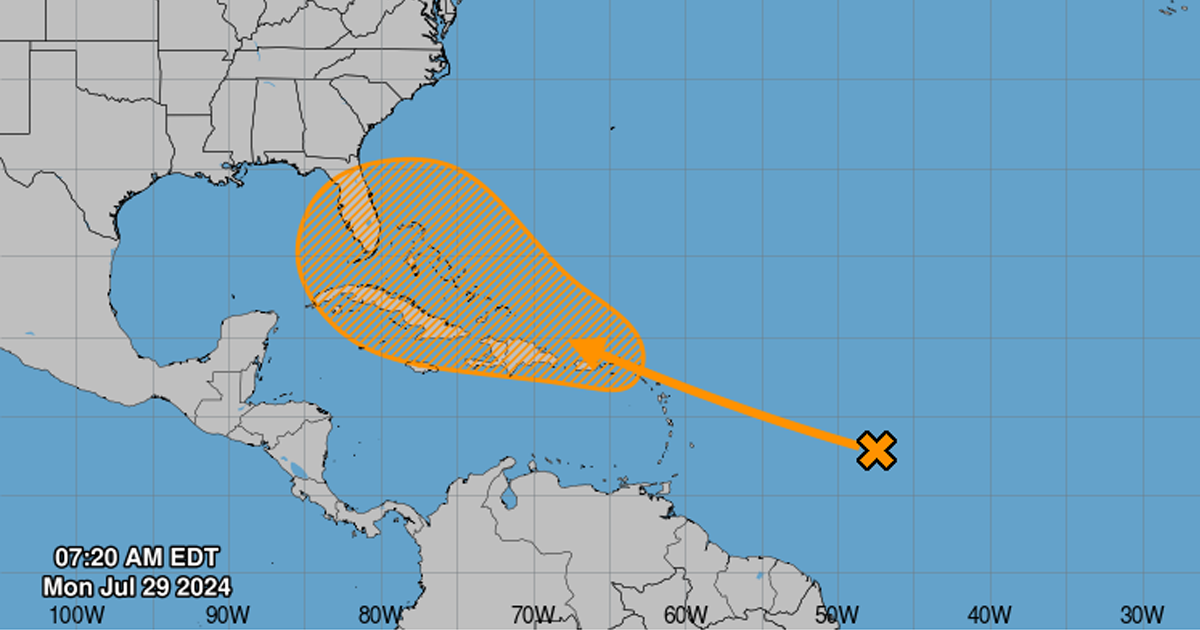
MIAMI.- The National Hurricane Center (NHC) warned that weather conditions could favor the formation of a tropical depression in the middle or end of this week and later even a hurricane if conditions allow.
The area of interest that meteorologists are monitoring includes the northern Leeward Islands, the Greater Antilles, the southwestern Atlantic Ocean and the southeastern Bahamas. However, if the disturbance intensifies into a tropical cyclone, current projections indicate that its path would approach the coasts of Florida or the southeastern region of the United States.
“Possible tracks range from east of Florida to a path toward the Gulf of Mexico. Obviously, there are a number of next steps with this system,” said FOX Weather hurricane specialist Bryan Norcross.
According to the NHC, the chance of the current patch of clouds and rising air becoming a tropical cyclone is 50% in the next seven days. On Sunday, the chance was 40%.
A tropical depression is expected to form mid- to late-week as the system moves from the northern Leeward Islands toward the southeastern Bahamas.
Despite the presence of Saharan dust, the accumulated humidity in the area could be enough to generate a cyclone, according to climate experts.
Colorado State University has raised the number of named storms expected for the season to 25, up from 23 in June.
Meteorologists warn that the season is still in progress and that the threat of hurricanes persists for months to come.