
The US National Hurricane Center (NHC) said Hilary’s maximum sustained winds had increased to 120 mph (195 km/h).
The meteor is expected to reach a Category 4 on Friday as it moves on a trajectory that could make landfall in the central Baja California Peninsula by Sunday, or possibly hover over the sea as it heads toward southern California.
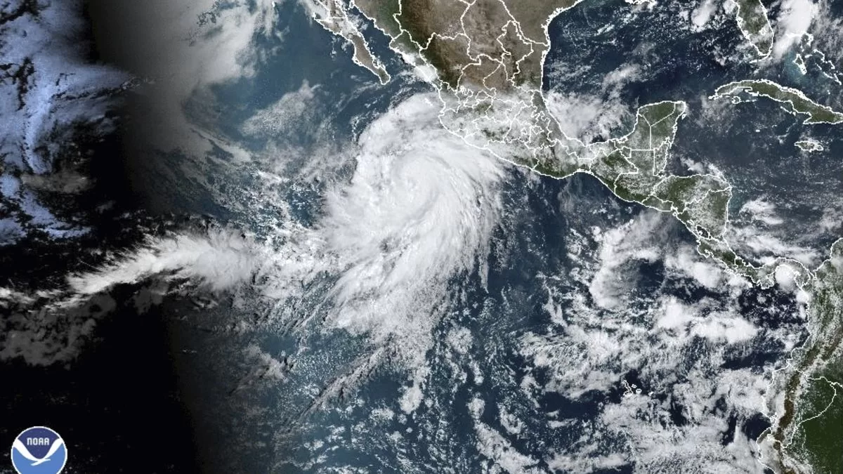
The center of the storm was located about 715 kilometers (445 miles) south of Los Cabos, on the southern tip of the Baja California Peninsula. It was moving in a west-northwest direction at about 14 mph (22 km/h), but is expected to turn north in the coming days.
The NHC said that as Hilary approaches or brushes the Baja California Peninsula, it could briefly survive as a storm or tropical depression and cross the border into the United States.
No tropical storm has made landfall in southern California since September 25, 1939, according to the US National Weather Service.
“Hilary’s rainfall within the southwestern United States is expected to peak this weekend and into Monday,” the NHC said. “Urban and flash flooding are a possibility with potential for significant impacts.”
The area that could be affected by the heavy rains could extend from Bakersfield, California, to Yuma, Arizona, as well as parts of southern Nevada.
The excessive rain forecast for southern California spans Sunday through Tuesday, according to the Los Angeles weather bureau.
Although the chances of Hilary making landfall as a tropical storm in California are slim, heavy rains and flooding are possible, UCLA climatologist Daniel Swain said Wednesday.
FOUNTAIN: Associated Press