HAVANA.- The National Hurricane Center (NHC) reported the formation of potential tropical cyclone number four over Cubafrom a onda tropical which began to affect the eastern part of the Island with rain and storms.
According to the report of that entity, based in Miami, at 11:00 AM of this day the potential tropical cyclone was located approximately 144 kilometers east-southeast of Camagüey, with maximum sustained winds of 48 kilometers per hour, according to the website Cuba Diary.
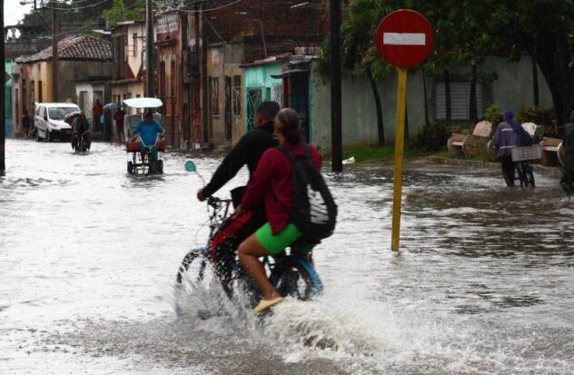
For its part, the Forecast Center of the Cuban Institute of Meteorology (INSMET) warned that there would be a significant increase in the probability of showers, rain and thunderstorms in eastern and central Cuba.
“In the active tropical wave that has been moving over Cuban territory, an elongated area of low pressure has been developing, which is located over a wide area that covers the central region of Cuba and the adjacent seas of the southern coast,” said the Forecast Center of the Cuban Institute of Meteorology (INSMET) In its special notice number 2 issued at 1:00 am this Saturday, August 3, the web portal reports CubaNet.
“A tropical depression may be forming in this area, which will become noticeable once the system advances over the warm waters of the Florida Strait and the northeastern Gulf of Mexico, starting in the late morning and midday today, Saturday,” they added.
The report states that “the meteorological situation described does not change the forecasts that have been issued for Cuba in the next 24 hours.”
Source: Writing