MIAMI.- Researchers at the University of Florida’s Institute of Agricultural and Food Sciences are prepared for hurricane season with state-of-the-art monitoring equipment that will help them determine how extensive damage is to forests during hurricanes.
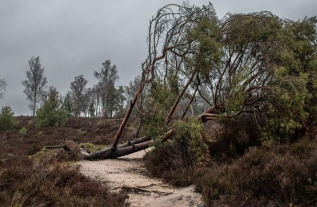
When hurricanes hit Florida, they not only damage homes and businesses, but they also destroy forests and timber farms. Getting an accurate assessment of how much wood is damaged by hurricanes is essential for environmental management decisions, logging operation recovery, forest farm insurance estimates, and climate change studies, but until now it has been an enigma. disconcerting, the university indicated in a press release.
Carlos Silva, assistant professor of quantitative forestry science at the UF/IFAS College of Forestry, Fisheries and Geomatics Sciences and director of the Forest Biometrics, Remote Sensing and Artificial Intelligence laboratory, said the key is to use a combination of remote sensing and artificial intelligence, to create 3D maps of forests before and after the hurricane to assess forest loss.
To achieve this, satellites and a technology that uses lasers to collect data called Light Detection and Ranging (LIDAR) are used.
“Hurricanes pose a fundamental challenge for us in Florida”Silva said. “The traditional way to assess the impact of hurricanes is basically to go into the field, establish plots and measure trees. But if we think about large areas, it takes a long time, so the traditional way of evaluating the impact of hurricanes on forest ecosystems is not efficient.”
“We are in a new era for forest monitoring, thanks to these innovative methods of remote sensing and artificial intelligence,” he said.
Kody Brock, a senior in Silva’s lab, said the maps can help both forest managers and landowners react quickly to hurricane damage.
“Hurricanes will only get worse and more frequent,” He stated, “and we realize this in the forestry field. “Those are ecosystems that we are losing.”
According to the Colorado State University hurricane forecast team, the 2024 hurricane season is shaping up to be an active season. The team predicts 23 storms. Of them, 11 will be hurricanes and five will be category 3 or stronger.
Silva and his lab used NASA satellites, specifically the Global Ecosystem Dynamics Research (GEDI) satellite and the Ice, Cloud and Land Elevation Satellite (ICESat-2), to scan trees on the ground with a laser pulse. which sends data about the structure. from the forest, he added
Additional data is collected with ground scanners attached to all-terrain vehicles and a backpack device to create high-resolution 3D maps of the forest.
LIDAR and image data from satellites and ground sensors are combined into a web-based mapping platform that shows a complete picture of the hurricane’s impacts on forest ecosystems.
Source: UNIVERSITY OF FLORIDA