
Part of the natural threats to which Guatemala is exposed is the volcanic activity of the Colossi of Fuego, Pacaya and Santiaguito, which is kept under constant supervision by the National Coordinating System for Disaster Reduction (Conred). .
In the last few hours, each of these volcanoes has presented various types of activity, according to the most recent report released by the National Institute of Seismology, Volcanology, Meteorology and Hydrology (INSIVUMEH) this Friday, August 18.
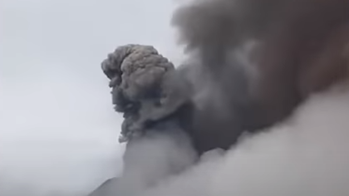
The OVFGO Fuego volcano observatory reports weak degassing at 4300 masl that disperses to the West and Southwest. There are 6 to 10 explosions per hour of weak and moderate characteristics, these explosions generate columns of ash with heights of 4,500 to 4,800 meters above sea level (14,764 to 15,748 feet) that disperse from 10 to 20 km in a West and Southwest direction. Avalanches are also recorded around the crater and in the direction of the Ceniza, Jute, Las Lajas and Honda ravines. At night and early morning an incandescent pulse is observed from 100 to 250 meters above the crater. Ash fall is reported in the communities of Panimache I, Morelia, Santa Sofía, El Porvenir, Panimache II, Finca Palo Verde, Sangre de Cristo, Yepocapa and other nearby communities.
The Pacaya volcano observatory reports unfavorable atmospheric conditions for observing the volcanic complex. INSIVUMEH’s seismic stations record short, low-frequency events due to the movement of magma and gases within the volcanic edifice, as well as due to prolonged or abundant degassing periods in the crater.
The Santiaguito OVSAN observatory reports constant degassing over the crater. Weak and moderate explosions have been recorded, expelling columns of gas and ash to a height of up to 900 m above the crater that disperse in a West and Southwest direction. At night and early in the morning, incandescence was observed in the crater of the hot dome and in the lava flow in a West-Southwest direction. Weak and moderate avalanches are recorded in the lava flow and on the South, Southeast and East flanks. The volcano maintains a high activity due to the extrusion of lava in blocks in the dome of the Hot Dome in a West-Southwest direction and the unstable material in the crater, there is a probability of moderate to strong pyroclastic flows so you should not stay near nor within the riverbeds near the slopes of the volcano.
The most active volcanoes in Guatemala
Due to its location in the Pacific Ring of Fire, volcanoes cover a large part of the country’s geography, making it one of the regions with the highest density of these rock formations.
Despite the fact that at least 324 structures of volcanic origin have been determined in Guatemala, the National Geographic Institute (IGN) admits only 32 volcanoes, while the National Mountaineering Federation says there are 37. The remaining 287 are called by INSIVUMEH as “ eruptive foci”.
However, regardless of the differences, there are currently three active volcanoes that are under surveillance by the Guatemalan authorities: the Fuego, Pacaya and Santiaguito volcanoes.
The strongest eruptions of the Fuego volcano
Located between the departments of Sacatepéquez, Escuintla and Chimaltenango, Fuego is the most active stratovolcano in Central America and one of the most important worldwide.
With more than 3,763 meters above sea level, this volcano has recorded various violent eruptions throughout its history, such as the one in 1932, when it covered the city of Antigua Guatemala and some parts of Honduras and El Salvador with ash; that of 1974 when its pyroclastic flows ruined part of the surrounding vegetation and partially buried the communities of San Pedro Yepocapa and Acatenango.
On June 3, 2018, it had its largest eruption so far in the new millennium, with ash columns that reached 10,000 meters above sea level. This activity left 300 people dead, 200 missing, and 600 injured; as well as two million affected citizens.
The report of its last strong activity was on December 12, 2022, when the volcano erupted leaving columns of ash 500 meters high and generating a lava flow of 800 meters, with ash fall in locations 45 kilometers away. around.
FOUNTAIN: INFOBAE
