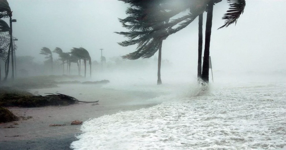
MIAMI.- Record high ocean temperatures and delayed El Niño effects have doubled the odds of a relentless hurricane season in the Atlantic this year, the US National Oceanic and Atmospheric Administration (NOAA) said Thursday.
As the Atlantic hurricane season has already exceeded its normal activity thus far, NOAA increased the number and intensity of storms it is forecasting. The agency estimates there is now a 60% chance that the hurricane season will exceed its normal number of storms, twice the chance it had forecast in May. The previous projection also gave a 40% chance of having a near normal season, but now that forecast has been reduced to 25%.
Although NOAA’s forecast does not include storm tracks or where the storms will be affected, an intense season like the forecast means that “the probability of a hurricane making landfall on the East Coast of the United States doubles,” said Matthew Rosencrans. , chief meteorologist for the hurricane season at NOAA’s Weather Prediction Center.
According to NOAA’s new forecast, there will be 14 to 21 named storms, compared with 12 to 17 forecasters initially projected in May. A typical year sees 14 named storms.
Of the named storms, NOAA expects six to 11 to be hurricanes, up from the five to nine included in the May forecast. Normal activity would be seven hurricanes.
Of that number, NOAA forecasts that at least two to five will be Category 3 hurricanes, with winds greater than 110 mph (177 kilometers per hour), which is one more than previous predictions. In a normal year there are three category 3 or higher hurricanes.
The forecast from an important measurement called Accumulated Cyclone Energy — which considers the number of storms, their power and their duration — is double what would be normal numbers in a year, NOAA said.
Other hurricane season forecasting groups have also revised their forecasts higher. Colorado State University increased the number of storms it has forecast: from 13 in April to 18 now, and from six hurricanes forecast in April to nine now.
The mere forecast shouldn’t scare residents, but “people should be concerned and prepare for the storms considered in this forecast,” Rosencrans said.
There have already been five named storms this year: Arlene, Bret, Cindy, Don, and an unnamed storm in January that was promoted to named and designated “unnamed.” Typically only two named storms occur up to this point in the year, Rosencrans noted. That was one of the reasons the figure was raised in the forecast, he added.
Persistently high temperatures in the North Atlantic, which are linked to climate change, are a key factor in upgrading the number of forecast storms because the heat has been greater and lasted longer than initially anticipated, Rosencrans said. Water temperatures in the main storm-forming region — an area between the western tip of Africa and the Caribbean — were 2.2 degrees Fahrenheit (1.2 degrees Celsius) above normal, the highest ever since records-keeping began in the 1950s, he said.
Warm waters are the fuel for hurricanes. The storm becomes more humid, has more water saturation and is more powerful.
Another factor has been “the delayed effects of El Niño in the Atlantic,” Rosencrans said. El Niño, a natural warming of central Pacific waters that changes weather around the world, typically reduces storm activity because its crosswinds and downdrafts tend to suffocate storms. Although El Niño is intensifying in the Pacific, its effects have not yet appeared in the Gulf of Mexico and the Atlantic.
FOUNTAIN: With information from AP