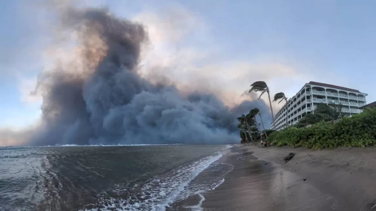
Wildfires raging at terrifying speeds on the Hawaiian island of Maui have killed at least 36 and destroyed parts of historic Lahaina City.
Driven by strong winds, Wildfires are among the deadliest in the United States in recent years. Thousands of residents have run to escape the flames and smoke, some fleeing into the Lahaina waters in a desperate race for safety.
This map below shows where the wildfires are burning on Maui. Zoom in to see additional fire spots indicating “thermal activity”.
Tourists have been told the island is not safe to visit and the state’s lieutenant governor described the situation as dire. Some 11,000 people were transferred off the island on Wednesday and more are expected to leave Thursday, according to state transportation officials.
The fires broke out in dangerous red flag conditions: dry, hot and windy weather that increases the risk of fires spreading with astonishing speed. The Hawaii fires were fanned by strong winds from Hurricane Dora, which is passing well south of the island chain.
Aerial video of Lahaina Town on Maui’s west coast showed rubble where historic buildings once stood. The city’s shopping and dining area along Front Street and its harbor were devastated.
“It is awful. I’ve flown here for 52 years and I’ve never seen anything come close to it,” said Richard Olsten, a helicopter pilot for a tour company. “We had tears in our eyes.”
The fires are the latest in a series of extreme weather disasters across the world this summer. Experts say climate change is increasing the likelihood of such events.
This story first appeared on Telemundo 52’s sister station, NBCLA. Click here to read this story in English.