MIAMI.- Cities from Atlantic Coast of USA are experiencing a ground subsidencesome as much as five millimeters per year, posing a major threat of damage to infrastructure in densely populated areas in these coastal urban centers, according to new research from the United States Geological Survey and Virginia State University.
The researchers warned that land subsidence is not an intangible hazard, this effect may be gradual, but the impacts are real and could cause catastrophic damage to urban areas in the near future.
Affected cities
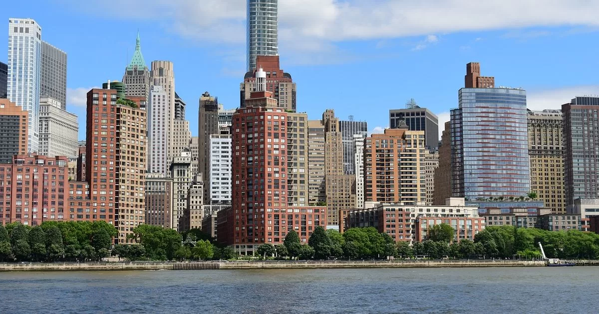
The study carried out by experts from the United States Geological Survey (USGS) and Virginia Polytechnic Institute and State University (Virginia Tech) confirms that populations along the East Coast, such as the city of New York, Long Island, Baltimore, Virginia Beach and Norfolk They are experiencing what they called “rapid sinking” areas.
According to a study carried out in May, the ground in New York, a city of 8.5 million inhabitants, is sinking between 1 and 2 mm per year, partly due to the pressure exerted by the buildings of the city. Geologists calculated that the More than one million New York buildings added a total mass of 762 trillion kilograms of downward pressure on the ground.
The researchers also detailed that there are areas in which the land sinks more slowly or is relatively stable.
They indicated that this means an increased risk for multiple road infrastructures, building foundations, railway lines, airports and dams, which are affected by different rates of subsidence.
Although it is not clear exactly what degree of threat this poses to people residing in these locations, the authors said that “a subsidence rate of more than a few millimeters per year could also cause concern in areas with essential facilities such as hospitals, schools or transportation centers.”
geological study
To obtain the findings, the team of scientists analyzed high-precision data measured through space-based radar satellites released by the USGS) to measure vertical land motion (VLM) up and down the East Coast from 2007 to 2020. .
They used this information to create high-resolution land subsidence and digital maps that reveal exactly which areas are sinking and at what speed.
They then calculated how much land has subsided along the east coast and in which areas and towns, and were able to determine that critical infrastructure within a 100 km radius of the coast is at risk of land subsidence.
Findings
The results published in the journal PNAS Nexus indicate that West Coast cities affecting more than two million people are sinking at least 2 millimeters (0.08 in) a year, with 867,000 properties located in these areas. Of the 172 counties examined, seven to 43 areas spanning 3,700 kilometers are declining about 5 millimeters (0.2 inches) per year. That’s greater than the current 4 millimeters (0.16 inches) annual rise in sea level, experts say.
“We measure subsidence rates of 2 mm per year affecting more than 2 million people and 800,000 properties on the East Coast,” said Manoochehr Shirzaei, associate professor at Virginia Tech’s Earth Observation and Innovation Laboratory.
These data confirm the results of a previous research published in April 2023 in the journal Nature Sustainability which had already found that the Atlantic coast of the United States descends several millimeters a year at a faster rate than the growth of the oceans
For this reason, scientists from the National Aeronautics and Space Administration (NASA) expressed concern about the sinking of some areas of the nation’s coast, due to the rise of the Earth’s surface as a result of sea warming.
Towards infrastructure maintenance
Lead author Leonard Ohenhen, a graduate student at Virginia Tech, said: “The continued and absolute subsidence of the US East Coast should cause concern. This is particularly occurring in areas with high population density, property ownership and a historical complacency towards infrastructure maintenance.
“The problem here is not just that the land is sinking. The problem is that critical points of sinking land intersect directly with population and infrastructure centers,” Ohenhen added.
Objective: plan
The Virginia Tech researchers specified that, for example, in New York, important infrastructure such as the John F. Kennedy and La Guardia airports and their runways are affected; In addition, railway systems due to subsidence rates exceeding 2 mm per year. A situation that experts consider as potential damage to infrastructure and increased risks of flooding.
They said that when combined with sea level rise caused by climate change, land subsidence can exacerbate coastal flooding, undermine building foundations, damage gas and water lines and cause buildings to collapse.
Studies have stated that the east coast of the United States could suffer a rise in sea level of about 30 centimeters between now and 2050.
“This information is needed. No one else is providing it, so with this study we are providing extremely valuable information,” said Patrick Barnard, a USGS research geologist and co-author of the study.
This analysis has far-reaching implications for community and infrastructure resilience planning, emphasizing the need for a targeted focus on transitioning hazard mitigation strategies from reactive to proactive in the era of climate change, experts emphasized. .
@Lydr05
Source: With information from PNAS Nexus magazine and EuropaPress